Green
Mountain Road
Point 18 Details
3 Hiking/Biking Trailheads, Back Country Roads
2.6 mi. between 17 & 18
Over 50 miles of mountain biking and hiking trails
Directions - The best way
to find Green Road is just watch for that 3 miles from Point 17.
Road Names - Green Rd.,
Stone CR-96, FSR-1113, on some maps Green Mountain Road.
New To Driving Back Roads? -
Read Our Back
Roading Tips
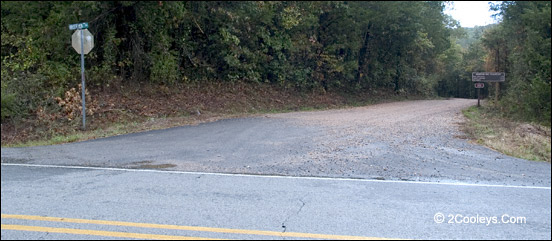
Green Road at Highway 5. Note the brown trail sign on the right.
Where Does It Go? - Access
to 3 trailheads for the Syllamo Mountain Bike
Trails & Hiking Trails. Connects to the Forest Roads Loop in 7.6 miles.
What Is It Like? - Green
road passes by several hunting camps on private property. You'll also see Townsend road,
which also goes to private property. You can drive this road in a regular sedan. The road
is carved into steep hillsides as it follows a long ridge line. It climbs in elevation
most of the way.
For Biking, Hiking, Walking -
Three nice trailheads all have gravel parking lots with Porta-Pottys. The White River
Bluff trail is 1.3 miles down the road, Scrappy Mtn. trail is 3.8 miles, and the Bad
Branch trail head is 5.6 miles down Green Road. You can hike or bike on any of these
trails.
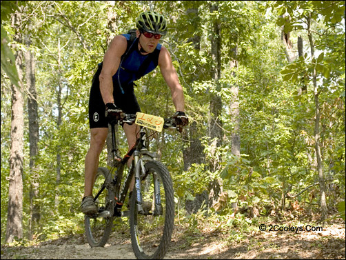
Mountain Biking - If you
want a serious mountain bike run, this is the place. There are 50 miles of trails in the
Syllamo Mountain Bike trail system (most of them single lane) in a stack of 5 loops. There
are other locations where you can access these trails. We highly recommend taking the time
to get the Forest Service map of these trails. The maps are available from the Ranger Station
in Mountain View.
Back to Top
|