North
Fork River & Old Railroad Bridge
|
Point 3
Details
2.6 miles from Y Store  |
It's been here for a long long time - and it still works
everyday
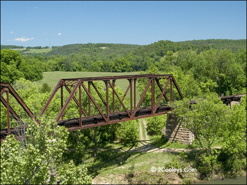
Norfork Historic Railroad Bridge -
Cross the Highway 5 bridge, then immediately pull over to the right. Park and walk over to
the end of the highway bridge so that you can see the old rail bridge clearly. Note the
stone columns holding it up. These stones were quarried on the steep hill directly above
you. Once cut out of the ground, the stones were slid down the hill to the bridge site.
Trains still cross this bridge almost daily.
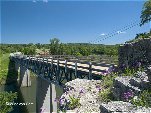
Highway 5 bridge at Norfork. Stand here to see both bridges
and the river.
Historical Note: Locals call this
river the "Norfork". On maps it is identified as the North Fork river. The
reason they call it "Norfork" is to distinguish it from the upper end of this
river, which is way up in Missouri. The Norfork is the 4 mile long tailwater flowing from
Norfork Lake dam to the White river. The first documented white man to map this river was
explorer Henry Schoolcraft in 1818. Schoolcraft's area map showed this river as the North
Fork, and the name stuck. Where the North Fork meets the White River 200 yards downstream
from this bridge is where the steam boats used to stop.
World Record Trout - As you approach the North Fork River bridge you'll see a sign
on the right saying "Welcome to Norfork World Record Trout." This record trout was caught in 1988 and weighted almost 39 pounds. It still
holds third place in World All
Tackle record standings. Trout fishermen from all over the world come here to fish the
North Fork River.
|