Blanchard Springs Caverns Recreation Complex (RR)
Point 24 Details
.3 mi. between 24 &
Fifty-Six
In Sylamore Creek National Scenic River Corridor
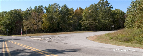
Turn here for Blanchard Springs Caverns
Road names: May show on some maps as
FRS 1110. Otherwise no road names are in common use. Look for a two-lane paved entrance.
All the roads in this recreation complex are paved. Hwy 87 is 0.2 miles from the entrance.
Highly Recommended. A rare spot allowing
you to see both underground and surface Ozark geology. And it's just plain beautiful
everywhere. If you have the time to do nothing more than drive through, it is time well
spent.
See Blanchard Spring
Caverns Photos
Many Activities - There is
actually more to do above ground than below. The CCC built most of Blanchard in 1940 and
1941. Cave tours, swimming, trout fishing, historical site, RV sites, camping sites, group
campgrounds, hiking trails, mountain bike trails, picnic tables, rest rooms with hot
showers and flushing toilets, handicap accessible nature trail, gift shop with Ozark trail
books and Ozark flora/fauna field guides.
A Quick Tour - A board walk
takes you to the stone skeleton of a grist mill built in the 1880's. Next to the mill is a
beautiful stone dam and waterfall. Behind it is Mirror Lake where you an see the unique
blue-green water from the caverns. A stone walkway takes you to this attraction's name
sake - Blanchard Spring. You'll see two artistic stone arch bridges over Blanchard Spring
Creek. Now head back in the other direction and you'll come to one of the highest bluffs
in the Ozarks - Sandfield Bluff. There's an overhang here you can walk under. Then drive
around through the lower and upper campgrounds. There are picnic tables, restrooms with
hot showers, two swimming holes, pavilions, hiking trails, and mountain biking trails.
Trout fish in Mirror Lake.
Three Sections of the Complex - The Blanchard Springs Caverns Recreation Complex has three
sections. The first section, or top section, is where the Visitor Center is. The two lower
sections can be called the Lower Left Side and the Lower Right Side. It's 2.6 miles from
Hwy 14 to the lower Blanchard sides. Once you turn into Blanchard you'll go past a ticket
house that's no longer in use. At 1.5 miles you turn right to go to the upper section,
which is the Visitor Center, gift shop, Accessible Trail, Spring Trail trailhead, and
cavern tours. To reach the two lower sections you keep going straight, down the hill, and
in 1 mile you come to a fork in the road. Turn right to get to Mirror Lake and the
Blanchard Spring the Right Side section. Turn left to go to all other features on the Left
Side section. All roads are paved.
Upper Section Attractions
Visitor Center & Gift Shop - Tour
the exhibit hall, watch the movie, then spend some time in the gift shop. Of particular
interest are the area maps and flora/fauna field books for identifying local trees,
wildflowers, and wildlife. This is also where you buy your cavern tour tickets, and where
all tours start and end.
The Accessible Trail
- If want just a short, easy walk through the woods it gets no smoother than this loop
trail. It is paved all the way, for 3/4 of a mile through the woods. Trailside benches are
placed every 250 feet. The wide, smooth paved trail is perfect for wheelchairs and
strollers. It flat enough for wheel chair use. You'll hear birds and may see other
wildlife and wildflowers. Beautiful during spring and fall foliage. The Accessible Trail
begins and ends at the Visitor Center parking lot.
Dripstone Trail Cavern Tour
- The shorter, easier cave tour, about a half-mile long one way. Well lit, smooth
sidewalks in most places. Wheelchair accessible, but strong assistants needed. Two large
rooms filled with a wide variety of crystalline formations, flowstone, huge columns, and
delicate "soda straws". Forest Service interpreters explain what you are seeing
and answer questions along the tour. Dripstone is open every day April through October.
It's closed Mondays and Tuesdays, as well as on Thanksgiving, Christmas, and New Year's
Day.
Discovery Trail Cavern
Tour - Following the path of the first explorers, this is a longer, more
strenuous tour of 1.2 miles. There are some 700 steps so it's not recommended for people
having heart, walking, or breathing difficulties. The Discovery Trail follows water-carved
passageways along the cave stream. Enormous rooms are filled with well-lit impressive
formations. Forest Service interpreters explain what you are seeing and answer questions
along the tour. The Discovery is open from Memorial Day weekend through Labor Day. Fee is
$10 per adult, $5 child age 6 to 15.
Wild Cave Tour Cavern
Tour - Put on hiking boots and prepare to get dirty! You'll tour an undeveloped
section of the caverns. This is a lot of fun for those who dare to do it. Experienced
guides lead the tour. Hard hats, knee pads, gloves, and lights are provided. One needs to
be in good physical shape and wear sturdy hiking boots. You'll crawl on hands and
knees, pass under low ceilings, and travel through red clay. Participants must be age 10
or older. A responsible adult must accompany children age 12 and under. Wild Cave Tours
are available by reservation only. It's open every day from April through October. From
November through March it's closed Mondays, Tuesdays, Thanksgiving, Christmas, and New
Year's Day. Fee is $75 per person.
Lower Right Side
Attractions
There are no bathrooms, picnic tables, or
swimming on the right side of the complex. However, there are several bathrooms and picnic
sites when you come back to the left side of the complex.
Mirror Lake, Accessible Parking
Lot, Old Grist Mill Historical Site, & Board Walk - The first thing you'll
see after you turn right is the paved parking lot for Mirror Lake. At the end of the
parking area is a very nice board walk that allows wheelchair access to Mirror Lake. The
board walk is a pretty stroll through the woods. On the way to the lake, which is only
about 150 yards away, is the site of an old grist mill. You stand on the board walk
looking down at the stone building frame which was built in 1880's. This mill was once a
commerce center for area settlers.
As you at the old mill it's fun to think
about what it must have taken to build it way down in that creek bottom. It was a lot of
work for horses, mules, and oxen to haul in, and then haul back out, loads of grain and
flour through these hills. The roads in and out where muddy and full of rocks.
Continue on past the grist mill and you
come to the Mirror Lake waterfall flowing over the dam built for powering the old grist
mill. Blanchard Creek flows a short distance from here before flowing into North Sylamore
Creek. A railed walkway allows you to get up close to the fall. It's a pretty spot to look
out over the lake, which is actually a large pond. The water in Mirror Lake is a unique
green turquoise color due to the dissolved limestone and minerals picked up in the caves
through which the water flows. The board walk continues for another 150 feet and is used
as a fishing pier. A set of steps built by the CCC in the early 1940's leads up from the
waterfall to a roadside parking spot.
Mirror Lake Trout Fishing
- Mirror lake is stocked with rainbow trout, most of which are 12 to 16 inches in length.
You will need an Arkansas fishing license and your own bait and tackle. Licenses, bait,
and tackle are not sold on site. You can fish anywhere all around the lake. The fishing
pier is wheelchair accessible.
Blanchard Spring - Drive down to the
end of the road and you'll see two photogenic stone arch bridges. A beautiful board walk
trail a few hundred yards long crosses, then follows Blanchard Creek to it's source -
Blanchard Spring. The underground creek running through the caverns comes roaring out at
Blanchard Spring, forming Blanchard Creek, which fills Mirror Lake, then flows into North
Sylamore Creek down by the swimming area. Watching this spring for a few minutes leaves
one understanding how the Ozark Mountains where shaped over many hundreds of millions of
years.
Springs Trail - A 1.5 mile trail runs
from the Visitor Center down to Blanchard Spring. It runs along Blanchard Creek and Mirror
Lake up to the Spring. This trail can be accessed from a couple of places and makes a very
good wooded walk. It is not a difficult trail to walk. Beginning at the parking lot up by
the spring walkway is a short trail section about 1/4 mile long. It takes you down
the side of Blanchard Creek, then down the Mirror Lake shoreline. At the waterfall it
drops down below the dam where you can walk over next to the water fall under a large rock
overhang. From here the trail leads back up to the parking lot at the end of the board
walk. You can walk back up the trail the way you came, or walk down the road back to your
car. Or you can finish the hike and end up at the Visitor Center parking lot.
Lower Left Side
Attractions
This side of the Blanchard Recreation
Complex has all the camp grounds, swimming, bathrooms, water hydrants, hiking trail
access, mountain bike trail access, group camping, and Sandfield Bluff.
Turning To The Left: From
the road fork bear left and just 0.1 of a mile you'll come to the Group Camp Site on your
left. Just past that on your left is a large parking area, a large lawn, and a large
pavilion. There are also two public restrooms here. Several picnic tables can be found at
the edge of the tree line across the lawn. These picnic tables are some of our personal
favorites. The large lawn makes a great place for children to play as adults can watch
them from the shaded tables. You can also walk over to what is called Shelter Cave on some
maps, now commonly known as Sandfield Bluff.
Sandfield Bluff - This is one of the
highest bluffs in the Ozarks. It extends even further down below the soil line for many
more thousands of feet. As you stand and look up you feel extremely small. A small cavity
at the base allows you to get in under the bluff. A footpath runs along the bluff base
over to the Amphitheater. Back in the days when the Forest Service had a larger budget
they presented some very good programs in this natural theater.
Group Camping - The large grass area
near the road by Sandfield Bluff is the group camping site. A minimum of 8 people, and a
maximum of 50 people, can reserve this spot for group camping. Scouts, churches, and
corporate retreats are held here each year. For information or reservations call the
District Office at 870-269-3228.
Picnic Tables - Right after the group
camping area you'll find another large parking lot and grass yard. Walk across the grass
and you'll find several picnic tables in the shade. These sites are popular with parents
as their children can play along the rocks, or out in the grass as they watch in the
comfort of the shade.
Bathrooms - All the bathroom buildings
have flush toilets, hot showers, and water hydrants. Bathrooms are in six areas. The first
is in the group camping area, the second is nearby at the back of the large grass yard,
the third is at the swimming area across the bridge, the fourth is in the first
campground, and the fifth is in the second campground. And of course there are bathrooms
at the Visitor Center.
Swimming - If you, or
your children, have never experienced the joy of swimming in clean clear water in a
natural setting, this is the place. Tell them they'll be swimming just as Native American
children did for thousands of years. Hot showers, changing rooms, and bathrooms are right
on the beach. A beach along a rugged Ozark stream? There's two here. Both swimming areas
have beaches and bathrooms. One swimming hole is across the bridge to your right as you
come down the road. The second is at the upper campground just after you drive through the
creek at the low water bridge. Swim at your own risk as there are no lifeguards on duty.
NSCT Hiking - The North Sylamore Creek
Hiking Trail (NSCT) can be accessed in two
places. Both are close to each other. The first trailhead you'll come to is for the trail
section heading north to Gunner Pool 5.1 miles up the trail (Point 25 area). The second
trailhead is for the trail section heading south to the Allison trailhead in 4.7 miles (Point 22). The Gunner Pool
trailhead is over by the large restroom building at the edge of the large grass yard for
group camping. Look for the white trail sign. The Allison trailhead is over across the
bridge in the swimming area parking lot. You'll see the signs at the edge of the parking
lot as you cross the bridge.
Mountain Bike
& Hiking Trail Access - The Blanchard Spur trail gives access to both the 50
miles of the Syllamo
Mountain Bike Trail, and a 1.6 mile foot hiking trail. Mountain bikers should follow
the yellow blazes. Hikers should follow the green blazes.You can get trail maps at the
visitor center. You'll find the Spur down by campsite #13. Go across the creek and turn
left. Go down past the last camp site. On your right look for a large wood timber gate
with a sign saying "Road Closed". To the right of this big gate you'll see the
trail. The road is closed to motor vehicles, but you can walk it. This is FSR 1107 that
winds up the hill coming out on Green Road (Point 18
area) in 1.7 miles. This is an old road good for
walking if you don't want to hike. Walk for a short distance, then come back.
Camping Sites - The lower campground has 14 creek side
camping sites with hot shower and restrooms with flushing toilet. Each site has tables,
grills, fire pits, and lantern poles. The upper campground has 18 forest camping sites
with hot shower and restrooms. Each site here also has tables, grills, fire pits, and
lantern poles. There is no electric or running water at the camping sites but there is
running water near the rest room buildings.
RV Sites - There
are no RV hookups, no electric or water or sewer. However there are water hydrants and a
dump station. RVs longer than 30 feet may have trouble maneuvering in the upper camp
ground.
General
Information
Day Use Fees - If you swim
or park for hiking, etc. there is a self- service pay station where day use fees apply.
This means you put a few dollars (usually $3) in the provided envelop and drop it into a
slot in a big steel pipe. The current fee is always posted by the steel post. If
you buy a cave tour ticket you don't have to pay the day use fees. If you just drive
through and don't stop for long, day use fees are not required.
ATV Use - There are no ATV
trails at Blanchard. ATV use in the Blanchard Complex is not allowed.
Pets - Except for
seeing eye and service dogs, pets are not allowed in the Visitor Center or caverns. Pets
are welcome in the recreation areas outside the swimming areas. There are no kennels. Pets
must be on a leash at all times, and must be accompanied. To keep from disturbing other
visitors please keep your dog from barking.
Supplies & Dining -
About six miles away is the little town of Fifty-Six. Hacker's Store sells food, gas, ice,
some camping supplies, and some military surplus items. Since Hacker's has served campers
for many years, they have at least the basic necessities, as well as some extras. Down the
street a couple hundred yards is Cody's Restaurant. Blanchard Springs Liquor Store is
about 10 miles away.
Wheelchair Accessibility -
All the facilities at the Visitor Center are accessible. All restrooms and bathhouses are
accessible. Mirror Lake has an accessible parking lot, trail to the lake, and fishing
pier. The Dripstone cavern tour is accessible but strong assistants are needed to provide
control on steep ramps. You must provide your own assistants, but a wheelchair is
available on request. The Accessible Trail is a beautiful half-mile paved loop through the
woods at the Visitor Center.
Phone Numbers:
Toll Free General Information, Mtn. View Ranger Station - 888-757-2246
Local General Information, Mtn. View Ranger Station - 870-757-2211
Group Camping Information - 870-269-3228
Address is NF 54, Forest Road 1110A
Ranger Station is at 1001
East Main Street in Mountain View, Arkansas
Returning To Main Tour Loop
- The fastest way back to Mountain View is to turn left when back out at Point 23 on
Highway 14 at the Blanchard entrance, go 0.2 miles, then turn right onto Hwy 87. It's a
pretty 10 mile downhill run to Main Street in Mountain View. The fastest way back to
Mountain Home is to turn right onto Hwy 14 at the Blanchard entrance and continue to
follow the main tour loop.
See Blanchard Spring
Caverns Photos
Back to Top
|